
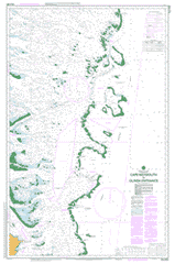
AUS 836
Cape Weymouth To Olinda Entrance
Please note that all charts are nominally folded in half for storage and handling as per the marine industries standard.
If you require an unfolded copy (ie: flat for framing), please select Flat Paper, and we will organise a special print service to accomodate your request.
Description
This official Nautical Chart is produced by the Australian Hydrographic Office, and corrected fortnightly to 'Notice to Marines' by Cairns Charts & Maps. This ensures it remains compliance with Safety of Navigation requirements. This marine chart, or 'sea map', is primarily produced to support the safe navigation of commercial shipping through Australian, Papua New Guinea and Solomon Island waters.
Nautical charts depict the seabed, or bathymetry, using a variety of colours to shade the depth regions. Darker blues indicate shallower water, while light blues and white indicate deeper water.A chart will also show continuous contour lines (at varying intervals depending on the scale of the chart), 'spot depths' across the whole area, as well as different symbols indicating wrecks, shallow rocks and dangers, as well as details on lights, light houses, tides and currents.
For extensive detail on the symbology of nautical charts, the Symbols and Abbreviations used on Admiralty Charts is the definitive reference.
Albatross Cove Ashmore Banks Aylen Hills Black Rock Entrance Black Rocks Blackwood Channel Blue Bell Rocks Brierly Reef Burke Reef Carmichael Cay Caroline Rock Chilli Or Gunyah Creek Curd Reef Dolphin Reef Double Rock Edward Shoal Eel Reef Ferguson Reef Fison Reefs Five Reefs Forbes Islands Gallon Reef Great Detached Reef Cape Griffith Gunyah Or Chilli Creek Henry Reef Inman Rock Job Reef Jukes Reef Lagoon Reef Lambert Hill Lloyds Reef Log Reef Long Sandy Reef Martha Ridgway Reef Mason Reef Middle Banks Middle Reef Moulter Cay Nimrod Passage Nomad Reef Northern Small Detached Reef Old Man Rock Olinda Entrance Packers Creek Pandora Entrance Pollard Channel Portland Road Providential Channel Queue Reef Quoin Island Quoin Island Entrance Raine Island Raine Island Entrance Restoration Island Restoration Rock Rocky Island Safe Entrance Salamander Reef Sandy Islet Scrub Hen Creek Second Small Reef Single Rock Entrance Sir Charles Hardy Islands Southern Small Detached Reef Star Reef Stead Passage Symonds Passage Tannadice Rock Tannadice Shoal Three Reefs Turning Point Patches Tynemouth Rock Cape Weymouth William Reef Wilson Creek Wishbone Reef Wreck Bay Wreck Reef Yule Detached Reef Forbes Islands National Park Quoin Island National Park Restoration Island National Park Sir Charles Hardy Group National Park Maclennan Cay Stark Reef Saunders Reef Cochin Reef Shadwell Reef Siddons Reef Pearson Reef Bowles Reef Indefatigable Cay Kupuntutu Passage McGillivray Reef North Channel Inman Pig Island Pig Islet Yules Detached Reef Martha Ridgway Reefs Hanry Reef Mantis Reef Forbes Islets Eft Reefs Fison Reef Quoin Island Passage Quoin Bunker Reef Symonde Pass Por Island Rocky Islet Edwards Shoals Edwards Shoal Chili Creek Gunyah Creek Albatros Cove Red Hill Ape Reef