
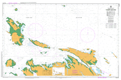
AUS 40
Yampi Sound
Please note that all charts are nominally folded in half for storage and handling as per the marine industries standard.
If you require an unfolded copy (ie: flat for framing), please select Flat Paper, and we will organise a special print service to accomodate your request.
Description
This official Nautical Chart is produced by the Australian Hydrographic Office, and corrected fortnightly to 'Notice to Marines' by Cairns Charts & Maps. This ensures it remains compliance with Safety of Navigation requirements. This marine chart, or 'sea map', is primarily produced to support the safe navigation of commercial shipping through Australian, Papua New Guinea and Solomon Island waters.
Nautical charts depict the seabed, or bathymetry, using a variety of colours to shade the depth regions. Darker blues indicate shallower water, while light blues and white indicate deeper water. A chart will also show continuous contour lines (at varying intervals depending on the scale of the chart), 'spot depths' across the whole area, as well as different symbols indicating wrecks, shallow rocks and dangers, as well as details on lights, light houses, tides and currents.
For extensive detail on the symbology of nautical charts, the Symbols and Abbreviations used on Admiralty Charts is the definitive reference.
Cockatoo Anemometer Hill Arbitration Cove Back Bay Back Beach Barramundi Bay Bathurst Island Billilli Spring Black Rock Bubb Point Catspaw Point Cockatoo Creek Cockatoo Island Collins Cove Comber Rock Conilurus Island Conspicuous Hill Copper Bay Coppermine Creek Crabbe Island Dorothy Island East Bay Ellis Fiord Finger Point Flora Island Front Beach Galah Channel Gibbings Island Goose Channel Hardstaff Point Iron Islands Irvine Island Jap Bay Jonas Point Kathleen Island Kean Cove Koolan Koolan Island Koolloo Koomi Point Koorollum Spring Laxton Point Lena Reef Malungurry Spring Mangrove Inlet Mcintyre Island Mud Bay Mullet Bay Myridi Bay Myridi Flat Nares Point No. 1 North Bay No. 2 North Bay No. 3 North Bay Nurumma Rockhole Parakeet Channel Phillips Cove Roberts Island Round Island Sanders Point Scaddan Island Silver Gull Creek South East Point Sweeney Patches Tanner Island Tarrant Island The Canal The Channel The Drain The Gutter The Piccaninnies The Sisters Usborne Island Wangania Island West Bay West Point Woodhouse Point Yampi Sound Yumurryumuh Beach McIntyre Islet Moore Island Tanner Islet Scaddan Islet Scaddon Island Margaret Island Yampi Canal Yampi Passage The Sisters Islands Gibbins Island Koorallum Spring Mulungurry Spring Balili Spring