
AUS 816
North Spit To Breaksea Spit
Please note that all charts are nominally folded in half for storage and handling as per the marine industries standard.
If you require an unfolded copy (ie: flat for framing), please select Flat Paper, and we will organise a special print service to accomodate your request.
Description
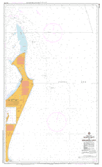
This official Nautical Chart is produced by the Australian Hydrographic Office, and corrected fortnightly to 'Notice to Marines' by Cairns Charts & Maps. This ensures it remains compliance with Safety of Navigation requirements. This marine chart, or 'sea map', is primarily produced to support the safe navigation of commercial shipping through Australian, Papua New Guinea and Solomon Island waters.
Nautical charts depict the seabed, or bathymetry, using a variety of colours to shade the depth regions. Darker blues indicate shallower water, while light blues and white indicate deeper water.A chart will also show continuous contour lines (at varying intervals depending on the scale of the chart), 'spot depths' across the whole area, as well as different symbols indicating wrecks, shallow rocks and dangers, as well as details on lights, light houses, tides and currents.
For extensive detail on the symbology of nautical charts, the Symbols and Abbreviations used on Admiralty Charts is the definitive reference.
Orchid Beach Eurong Akuna Creek Allom Lake Arch Cliff Awinya Creek Bare Hill Beemeer Bimjella Hill Binngih Lake Birrabeen Birre Black Creek Black Lagoon Blowah Lakes Blowah Rocks Boomanjin Airstrip Lake Boomanjin Boomerang Lakes Boowon Bowal Creek Bowarrady Bowarrady Creek Lake Bowarrady Breaksea Spit Bridge Creek Browns Rocks Burrgum Hill Calarga Lagoon Carree Chard Rocks Coomboo Lakes Coondagarramine Creek Coorong Creek Corroboree Beach Deepwater Lake Dipuying Dundubara Creek Eli Creek Enchanted Valley Ferguson Spit Flinders Fraser Island Freshwater Lakes Lake Garawongera Lake Geeoong Gerowweea Creek Lake Gnarann Goochee Lagoon Govi Creek Happy Valley Happy Valley Creek Hidden Lake Indian Head Jabiru Swamp Kirrar Koorooman Kurrnung Creek Leading Hill Long Shoal Maheno Beach Manann Beach Manoolcoong Lakes Markwells Spur Marloo Bay Marong Ridge Lake Marong Lake McKenzie Middle Rocks Lake Minker Moonbi Moondoora Lagoon Ngarr Lagoon North Channel North Ngkala Rocks North Spit Nulla Kunggur Nulwarr Hill Ocean Lake One Tree Rocks Orange Creek Pine Valley Platypus Bay Porpoise Shoal Poyungan Poyungan Rocks Poyungan Valley Rainbow Gorge Rooney Point Running Creek Salt Creek Sandy Cape Sandy Cape Shoal Seventy Five Mile Beach South Ngkala Rocks Station Hill Taleerba Creek Teahwan Teahwan Rocks The Cathedrals The Pinnacles Thow-Wool Lagoon Tooleenba Creek Tooloora Creek Towoi Creek Towoi Swamp Triangle Cliff Tukkee Urow-Wa Lakes Lake Wabby Waddy Waddy Point Wang-Ann Lagoon Lake Wanhar Wathumba Wathumba Creek Wathumba Swamp Lake White Wocco Lagoon Lake Woonjeel Woralie Creek Wyuna Creek Yathon Cliffs Lake Yeenan Yeerall Creek Yidney Lake Yindeering Lakes Boolla Lagoons Pile Valley The Declivity Fraser Island Hervey Bay City Fraser Sandy Cape Conservation Park Great Sandy National Park Moon Point Sandy Point Woakoh Lake Carrea North Gardner Bank Minker Orchid Beach Island Village North Triangle Cliff Triangle Cliffs Gardner Bank Arch Cliffs Lake Bowarrdy Great Sandy Island Boomerang Hill Bogumbah Creek Tree Creek Urang Creek Mangrove Creek Rocky Creek Seventy-Five Mile Beach Boomanjin Hill Lake Boemingen