
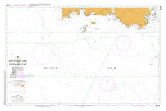
AUS 794
South West Cape To South East Cape
Please note that all charts are nominally folded in half for storage and handling as per the marine industries standard.
If you require an unfolded copy (ie: flat for framing), please select Flat Paper, and we will organise a special print service to accomodate your request.
Description
This official Nautical Chart is produced by the Australian Hydrographic Office, and corrected fortnightly to 'Notice to Marines' by Cairns Charts & Maps. This ensures it remains compliance with Safety of Navigation requirements. This marine chart, or 'sea map', is primarily produced to support the safe navigation of commercial shipping through Australian, Papua New Guinea and Solomon Island waters.
Nautical charts depict the seabed, or bathymetry, using a variety of colours to shade the depth regions. Darker blues indicate shallower water, while light blues and white indicate deeper water.A chart will also show continuous contour lines (at varying intervals depending on the scale of the chart), 'spot depths' across the whole area, as well as different symbols indicating wrecks, shallow rocks and dangers, as well as details on lights, light houses, tides and currents.
For extensive detail on the symbology of nautical charts, the Symbols and Abbreviations used on Admiralty Charts is the definitive reference.
Abeona Head Actaeon Island Actaeon Island Game Reserve Adams Point Alomes Gulch Amy Harbour Amy Range Anchorage Cove Arndell Falls Doom Head Driscolls Creek Duck Hole Eddystone Baldy Point Barbers Corner Bare Hill Bennetts Point Big Lagoon Beach Big Trumpeter Bay Black Beach Black Cliff Black Reef Black Witch Reef Blackhole Blackhole Creek Blackhole Plain Blackswan Lagoon Blanche Rock Blind Reef Blowhole Valley Bowdens Mistake Boy and Dinghy Bridge Point Buoy Creek Catamaran Catamaran River Chapman Creek Chicken Island Chinamans Corner Coachs Cove Coal Bluff Coal Pit Bight Coalbins Bay Cockle Creek Contact Cove Cox Bight Cox Bluff De Witt Island Deadmans Bay Deadmans Creek Deepwater Bank Denmark Reef D'Entrecasteaux River D'Entrecasteaux Watering Place ... Divaricate Creek Eliza Point Elusive Bluff Evoralls Point Finns Beach First Lookout Point Fishers Point Fishers Reef Flat Rock Plain Flat Top Island Flat Witch Island Fluted Cliffs Flying Scud Rock Fords Green Foxy Break Frog Flat Granite Beach Greens Creek Gagens Point George Creek George Third Rock Gillams Beach Goring Creek Grotto Creek Hardluck Creek Havelock Bluff Heathers Creek Hedgerow Creek Hen Island Hidden Bay Honey Smith Hill Hutchins Island Ile Du Golfe Inner Rocks Ironbound Range Jones Beach Karamu Bay Kelly Rocks Ketchem Bay Ketchem Creek Ketchem Island King Billy Saddle Knife Mountain Lake Mountain Lancasters Beach Landing Point Layka Creek Leaning Tea Tree Saddle Leprena Limestone Creek Lion Rock Lithograph Creek Little Lagoon Beach Little Trumpeter Bay Louisa Bay Louisa Creek Louisa Island Louisa Plains Louisa Point Louisa Reef Louisa River Lousy Bay Maatsuyker Group Maatsuyker Island Maatsuyker Lighthouse Maid Of Erin Reef Mary Ann Point Mazeys Rocks McDougalls Hill McKays Creek McKays Gulch Menzies Bluff Mewstone Middle Bluff Milford Creek Miller Lagoon Moss Glen Motts Beach Moulders Hill Mouldy Hole Mouldy Hole Creek Mount Karamu Mount La Perouse Mount Leillateah Needle Point Needle Rocks New Falls Creek New Harbour New Harbour Point New Harbour Range New River Lagoon New Year Bay Ningher Creek Ooze Lake Osmiridium Beach Outer Rocks Oval Lake Pancake Bay Pandani Knob Peachs Point Pearl Rock Pebbly Bight Pedra Branca Pigsties Bay Pigsty Bridge Pindars Peak Planter Beach Point Cecil Point Eric Point Vivian Prettys Inlet Prettys Point Prion Bay Prion Beach Purrar Point Quiet Cove Ramsgate Ravine Creek Recherche Recherche Bay Recherche Bay Nature Recreation ... Red Point Red Point Hills Reynards Beach Rocky Bay Rocky Boat Inlet Rocky Plains Rocky Plains Bay Round Top Island Ryans Point Sandstone Creek Sayers Beach Scrub Point Second Lookout Point Shag Rock Shoemaker Bay Shoemaker Point Sidmouth Rock Smoke Signal Hill Snake Point Soldier Bluff South Break South Cape South Cape Bay South Cape Range South Cape Rivulet South East Bay South East Cape South East Cape Reef South West Cape South West Cape Range Southeast Break Southern Ocean Southport Lagoon Southport Lagoon Conservation Area Sterile Island Stony Bight Sullivan Point Surprise Bay Surprise Rivulet Swallow Creek Swallows Nest Lakes Telopea Point Temple Point The Cockscomb The Hippo The Images Three Hillocks Three Tree Reef Turua Beach Tylers Creek Urquhart Creek Walker Island Waterhole Cove Western Rocks Whale Head Wierah Hill Wilson Bight Wilson Rocks Zebra Bay Bay Of Islands Boat Inlet Catamaran Cirque Cliff Point Coal Hill Cockle Creek Plains Cyclade Islands D'Entrecasteaux Cirque Endeavour Point Flensing Rock Fluted Range Georges Falls Glacial Shelf La Perouse Valley Lake Wolcot Liawenee Creek Little Deadmans Bay Maatsuyker Island Conservation Area Medial Moraine North West Point Open Bay Saltwater Inlet Stinking Bay The Pineapple George III Rock Pendare Peak Acteon Island New River Bay New Harbour Bluff The Pigsties Eliza Rocks Black Rock Mutton Rocks Sterile Islet DEntrecasteaux Watering Place Recherche Bay Nature Recreation Area The Waterhold First Look Out Point Point Arthur Ile du Golfe First Look Out Mouldys Hole Second Look Out Point Maatsuyker Islands Maatsyker Island Eddystone Island Pedra Blanca