
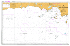
AUS 762
Investigator Island To Cape Le Grand
Please note that all charts are nominally folded in half for storage and handling as per the marine industries standard.
If you require an unfolded copy (ie: flat for framing), please select Flat Paper, and we will organise a special print service to accomodate your request.
Description
This official Nautical Chart is produced by the Australian Hydrographic Office, and corrected fortnightly to 'Notice to Marines' by Cairns Charts & Maps. This ensures it remains compliance with Safety of Navigation requirements. This marine chart, or 'sea map', is primarily produced to support the safe navigation of commercial shipping through Australian, Papua New Guinea and Solomon Island waters.
Nautical charts depict the seabed, or bathymetry, using a variety of colours to shade the depth regions. Darker blues indicate shallower water, while light blues and white indicate deeper water. A chart will also show continuous contour lines (at varying intervals depending on the scale of the chart), 'spot depths' across the whole area, as well as different symbols indicating wrecks, shallow rocks and dangers, as well as details on lights, light houses, tides and currents.
For extensive detail on the symbology of nautical charts, the Symbols and Abbreviations used on Admiralty Charts is the definitive reference.
Esperance 10 Mile Lagoon 11 Mile Beach 13 Mile Beach 6 Mile Hills 9 Mile Beach Adina Allora Bail Rock Bald Head Baleine Park Bandy Creek Bannitup Lake Barker Inlet Barney Hill Baudin Peak Baylemup Lake Bayliss Rock Baynes Rock Beagle Reefs Bedford Harbour Station Beltana Bishop Rock Black Island Black Rock Blue Haven Blue Waters Booeynup Boulder Hill Bow Park Boxer Island Boyatup Broomstick Hill Brown Reef Bukenerup Lake Bunbury Rock Buninyong Burton Rocks Button Island Butty Harbour Butty Head Callenup Canard Island Canning Island Canowindra Cape Le Grand Cape Le Grand National Park Capps Island Castle Rock Castletown Causeway Channel Cherry Well Chadwick Chantilly Park Chapmans Point Charley Island Cliff Island Cloud Island Coates Reef Collier Coobidge Creek Cook Rock Coolinup Swamp Coramup Creek Coramup Hill Corbett Island Cowerup Cull Island Dalyup Park Dalyup River Dalyup River Pioneer Reserve Dart Reefs Dauphin Park Davy Island Dempster Head Dempster Heights Park Devils Rock Dinner Camp Dolphin Rock Doombup Doombup Agricultural Area Doombup Creek Doombup Lake Douglass Patch Dunster Castle Bay Dwadiup Spring Edwards Well Elimatta Erinair Escape Rock Esperance Baptist Church Esperance Bay Esperance Golf Club Esperance Hospital Ewans Lake Fairfield Fanny Cove Figure of Eight Island Fourth Beach Frederick Island French Reef Frenchman Peak Fur Rock Fury Rock Fuss Gentle Creek Gerbryn Gerby Ghost Reef Giant Rocks Gig Rocks Ginginup Glen Valley Gorey Gorya Grace Darling Playground Gunton Island Hannett Crossing Harvest Reef Hastings Island Hector Rock Hellfire Bay Hendy Island Hood Island Hope Island Howe Island Hughes Step Humilaria Reef Investigator Island Investigator Island Nature Reserve Ivanhoe Jimberlana West Kalinda Park Kateup Creek Lake Carbul Lake Cobinup Lake Gidong Lake Gore Lake Kubitch Lake Mortijinup Lake Nambarup Lake View Lake Warden Lake Warden Farm Lake Williamup Lalor Park Langvale Leg of Lamb Bank Libke Island Limpet Rock Lion Island Little Devil Little Island Little Monjingup Lake Lock Rock Long Island Lort River Loughrea Lovers Beach Low Rock Lucky Bay Mackenzie Island Magistrate Rocks Mainbenup Swamp Manasah Marbellup Creek Marbellup Hill Margaret Cove Median Rock Melijinup Melijinup Lake Merivale Merivale Farm Merri Merri Mess Rock Middle Rock Minnikin Mississippi Hill Mississippi Point Mississippi Reefs Moby Dick Mondrain Island Monjingup Monjingup Lake Monjingup Reserve Moonanup Morning Star Mount Edward Mount Hannett Mount Le Grand Mount Merivale Mullet Lake Munglinup Beach Munglinup River Murray Rock Museum Park Myrup Myrup Agricultural Area Nangarup New Island North Bungaree Nulsen Nulsen Primary School Oake Marsh Farm Observatory Island Observatory Point Oink N Baa Oldfield Estuary Oldfield River Overland Park Pasco Island Peak Downs Picnic Cove Pink Lake Pink Lake Country Club Plumpudding Beach Portal Rock Pot Rock Quagi Beach Quallilup Lake Rabbit Island Ram Island Red Island Remark Island Ringwood Rob Island Rossiter Bay Roy Island Rsl Memorial Park Rug Rock Salmon Beach Sandy Hook Island Seal Rock Sealion Rock Shark Lake Shaster Downs Shelly Beach Shirilee Shoal Cape Sinclair Skinny Dip Bay Skippy Rock Smith Rock Square Rock St Germain Park Station Lake Steep Rocks Stevens Lakes Stockyard Creek Stokes Inlet Stokes National Park Strandheim Sunday Patch Sunk Rocks Sweep Rock Swell Rocks Tallaringa Taylor Rock Termination Island The Causeway Thistle Cove Thistle Rock Thomas Island Time Rock Tommy Windichs Grave Torradup Torradup River Trinity Rock Triple Rock Tuesday Rock Twiggys Landing Twilight Bay Twilight Beach Twin Rocks Wambesi Wangalee Downs Warreen Reefs Waterwitch Rocks West Beach West Channel West Group Whale Rock Wheatfield Lake Wheelbarrow Well Whistling Rock Wilga Bank Wilga Bank Spring Wilson Island Windabout Windabout Lakes Wireless Hill Woodup Swamp Woody Island Woody Lake Wylie Bay Wylie Head Yerritup Yerritup Creek Young River Caitup Gage River Salt River Edward Well Mambenup Boylemup Lake Little Monjingup Ginginup Wells Lake Gidon Lake Gage Six Mile Hill Munglinup Creek Collier Siding Rossiter Head Mount Hannet Bungidup Lake Spencer Lake Moirs Cook Rocks Buttys Head Butty Cove Bayliss Rocks Gull Island Charnley Island Frenchmans Peak Mandooburnup Mississippi Bay Cape Le Grande Hendy Isle Rocky Islands Rocky Island Rocky Islets Round Island Brown Reefs Little Islet