
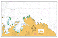
AUS 727
Rocky Island To Eclipse Islands
Please note that all charts are nominally folded in half for storage and handling as per the marine industries standard.
If you require an unfolded copy (ie: flat for framing), please select Flat Paper, and we will organise a special print service to accomodate your request.
Description
This official Nautical Chart is produced by the Australian Hydrographic Office, and corrected fortnightly to 'Notice to Marines' by Cairns Charts & Maps. This ensures it remains compliance with Safety of Navigation requirements. This marine chart, or 'sea map', is primarily produced to support the safe navigation of commercial shipping through Australian, Papua New Guinea and Solomon Island waters.
Nautical charts depict the seabed, or bathymetry, using a variety of colours to shade the depth regions. Darker blues indicate shallower water, while light blues and white indicate deeper water. A chart will also show continuous contour lines (at varying intervals depending on the scale of the chart), 'spot depths' across the whole area, as well as different symbols indicating wrecks, shallow rocks and dangers, as well as details on lights, light houses, tides and currents.
For extensive detail on the symbology of nautical charts, the Symbols and Abbreviations used on Admiralty Charts is the definitive reference.
Anjo Cove Anjo Hill Anjo Peninsula Anjo Point Atlantis Bay August Point Barton Plains Barton River Beauty Point Bertram Cove Beta Creek Binghi Rocks Bird Island Bluff Point Branch Banks Cape Bernier Cape Londonderry Cape Rulhieres Cape Talbot Cape Whiskey Carronade Island Circular Cove Cone Mountain Curran Point Deep Bay Dominic Creek Drysdale River East Governor Island Eclipse Hill Eclipse Hill Island Eclipse Islands Elbow Point Encounter Cove Evelyn Island Faraway Bay Fish Rock Fly Point Freshwater Bay Galley Point Geranium Harbour Geranium Islands Glycosmis Bay Gonai Governor Islands Guy Point Henry Reef Hill Point Honeymoon Beach Community Ian Bay Ila Point Jar Island Jones Island July Point June Point Kalumburu Kim Island King Edward River King George Falls King George River King Harman Point Klausmann Creek Koojarra Shoal Koolama Bay Lesueur Island Long Island Longini Louis Islands Low Island Low Point Mackenzie Anchorage Maia Cove Malinjar Mangarr Mary Island Middle Rock Mission Bay Mission Cove Mission Rocks Monger Creek Myola Bluff Napier Broome Bay Neewalara Point Nixson Point North Eclipse Island Noseda Creek Ooraro Hill Oyster Rock Pago Pauline Bay Pearl Shoal Pim Hill Placid Creek Red Bluff Rocky Cove Rocky Island Rosendo Creek Sandy Island Scorpion Island Scorpion Point Seaflower Bay Seaplane Bay Selsea Bill September Point Sharp Point Sir Graham Moore Island Sir Graham Moore Islands Steamer Rock Stewart Islands Symons Point Tait Bank Tate Point Tidepole Hill Troughton Island Troughton Island Aerodrome Truscott Airbase Truscott-Mungalalu Aerodrome Ubach Creek Vaia Point Vansittart Bay Wade Creek Waloobanbeningai Wanan Creek Waratah Shoal Wells Patches West Bay West Governor Island Womerah Bay Woppinbie Creek Stewart Islets Troughton Islet Jones Islet Koojarra Island Lesueur Islet Troughton Passage Eclipse Archipelago Governor Islets Louis Islets Rocky Islet Pago Mission Drysdale River Mission Station Jar Islet Oomari Longini Landing Oorara Hill