
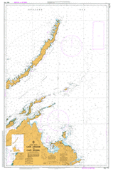
AUS 715
Cape Arnhem To Cape Wessel
Please note that all charts are nominally folded in half for storage and handling as per the marine industries standard.
If you require an unfolded copy (ie: flat for framing), please select Flat Paper, and we will organise a special print service to accomodate your request.
Description
This official Nautical Chart is produced by the Australian Hydrographic Office, and corrected fortnightly to 'Notice to Marines' by Cairns Charts & Maps. This ensures it remains compliance with Safety of Navigation requirements. This marine chart, or 'sea map', is primarily produced to support the safe navigation of commercial shipping through Australian, Papua New Guinea and Solomon Island waters.
Nautical charts depict the seabed, or bathymetry, using a variety of colours to shade the depth regions. Darker blues indicate shallower water, while light blues and white indicate deeper water. A chart will also show continuous contour lines (at varying intervals depending on the scale of the chart), 'spot depths' across the whole area, as well as different symbols indicating wrecks, shallow rocks and dangers, as well as details on lights, light houses, tides and currents.
For extensive detail on the symbology of nautical charts, the Symbols and Abbreviations used on Admiralty Charts is the definitive reference.
Nhulunbuy Yirrkala Gurundu Yanungbi Alcan Sports and Social Club Arnhem Rock Arnhem Shoal Astell Island Attack Shoal Auster Point Banyan Road Park Barbette Shoal Baringura Inlet Barricade Shoal Barrkira Barrkira Landing Ground Bilitch Island Birritjimi Beach Bitjpunhami Point Bonner Rocks Bosanquet Island Breakwater Point Bremer Island Bremer Island Landing Ground Bremer Islets Bremer Rock Bromby Islet Bromby Islets Buccaneer Rock Bukpukpoy Point Burston Bay Burungbirinung River Butjumurru Cape Arnhem Cape Wessel Cape Wessel Light Beacon Cape Wilberforce Cape Wirawawoi Captian Cook Community Centre Casuarina Park Cato River Cliffy Point Cotton Island Cumberland Strait Daliwuy Bay Dalywoi Bay De Belle Point Dholtji Djanbirrkpuy Beach Dolphin Rocks Donington Sound Drimmie Head Drimmie Head Landing Ground Drimmie Hill Drimmie Peninsula Dundas Point East Bremer Islet East Woody Beach East Woody Creek East Woody Island Elizabeth Bay Emu Islet Fern Tree Park Flat Rock Forlsche Rock Galaru Galupa Gangaru Lagoon Gangurimurru Beach Garanhan Beach Garrirri Beach Garrirri Creek Gedge Point Giddy River Gikal Gove Airport Gove Country Golf Club Gove District Hospital Gove Harbour Gove Hockey Club Gove Peninsula Gove Squash Club Granite Islands Gugari Rip Guluwuru Island Gunyangara Gunyipinya Creek Gurrukpuy Beach Guruliya Bay Guruwukpuy Point Gutjangan Guwatjurumurru Crossing Hagney Park Half Tide Point Half Tide Rock Hammer Point Harbour Islet Herald Islet Higginson Islet Hopeful Bay Inverell Bay Jandapa Hill Jasmine Park Jasper Park Jensen Bay Jensen Island Lagoon Bay Latram River Lions Park Lombuy Creek Lone Rock Low Point Malay Road Malinymirri Beach Mallarrami Marchinbar Island Marngarr Health Centre Martjanba Mata Mata Mata Mata Landing Ground Melville Bay Middle Bay Miles Island Miller Islets Mimosa Park Mithiwuy Point Mort Point Mount Bonner Mount Dundas Mount Saunders Munumbalwuy Swamp Nalwarung Strait Needle Point Ngumuy Beach Ngyaku Head Nhalanalwuy Rock Nhulunbuy BMX Club Nhulunbuy Cemetery Nhulunbuy Christian School Nhulunbuy Community Child Care Centre Nhulunbuy Community Library Nhulunbuy Community Neighourhood Centre Nhulunbuy Fire Station Nhulunbuy High School Nhulunbuy Police Station Nhulunbuy Pre School Nhulunbuy Primary School Nhulunbuy Scout Hall Nhulunbuy Senior Citizens Association Nhulunbuy South Oval Nhulunbuy Town Hall Nhulunbuy Town Oval 1 Nhulunbuy Town Oval 2 Nip Point Norruum Islet North East Bremer Islet North East Bromby Islet Old Eldo / Dhupuma College Site Osborn Point Parfitt Point Pelly Shoals Peter John River Pobassoo Island Point William Pugh Shoal Rainbow Cliff Raintree Park Raragala Island Red Point Reef Point Rika Park Rimbija Island Rimbija Landing Ground Rocky Bay Rocky Point Rorruwuy Rorruwuy Landing Ground Shark Point Shepherd Bluff Snapper Shoal South East Islet South West Bromby Islet Southwest Point Sphinx Head Strath Island Sykes Shoal Temple Bay The English Companys Islands Thumb Point Toad Point Town Beach Trafalgar Bay Truant Bank Truant Island Tuckeroo Park Two Island Bay Veronica Island Walkpuy Bay Wallaby Beach Wanaka Bay Wargarpunda Point Wathawuy Creek Wessel Islands Wessel Strait West Woody Island Wigram Island Wilirrwuy Point Wurwula Yangunbi Pool Yanungbi Landing Ground Yarrapay Point Yirrkala Community Education Centre Yirrkala Health Centre Yirrkala Pre School Yudu Yudu Sphink Point South West Cape Bromby Islands Bromby Isles Astel Island Pobassoo Islet Bosanquet Islet Veronica Islet Nalwarung Straights Gurjangan Woody Island Woody Islet Gove Nhulunby Nullumbuy Nhulunbuy Town Oval One Nhulunbuy Town Oval Two Yirkala Yirrkala Methodist Mission Yirrkala Mission Paperbark Swamp