
AUS 608
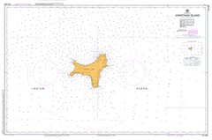
Christmas Island
Please note that all charts are nominally folded in half for storage and handling as per the marine industries standard.
If you require an unfolded copy (ie: flat for framing), please select Flat Paper, and we will organise a special print service to accomodate your request.
Description
This official Nautical Chart is produced by the Australian Hydrographic Office, and corrected fortnightly to 'Notice to Marines' by Cairns Charts & Maps. This ensures it remains compliance with Safety of Navigation requirements. This marine chart, or 'sea map', is primarily produced to support the safe navigation of commercial shipping through Australian, Papua New Guinea and Solomon Island waters.
Nautical charts depict the seabed, or bathymetry, using a variety of colours to shade the depth regions. Darker blues indicate shallower water, while light blues and white indicate deeper water.A chart will also show continuous contour lines (at varying intervals depending on the scale of the chart), 'spot depths' across the whole area, as well as different symbols indicating wrecks, shallow rocks and dangers, as well as details on lights, light houses, tides and currents.
For extensive detail on the symbology of nautical charts, the Symbols and Abbreviations used on Admiralty Charts is the definitive reference.
Aldrich Hill Allan Point Anderson Dale Andrews Point Bean Hill Bishops Cave Camp 4 Camp 5 Camp Hill Christmas Christmas Island Christmas Island District High School Christmas Island Golf Club Christmas Island National Park Daniel Roux Cave Darling Dale Deans Point Dolly Beach Dorothy Beach Douglas Point Drivers Cave Drumsite Egeria Point Ethel Beach Ferguson Hill Flying Fish Cove Freshwater Caves Freshwater Spring Gannet Hill Gladys Beach Grants Well Greta Beach Grimes Cave Hanitsch Hill Harrisons Spring Headridge Hill Henderson Spring Hewans Spring Hosnies Spring Hudsons Spring Hughs Dale Irvine Hill Isabel Beach Jacks Hill Jacks Point Jackson Point Jedda Cave John D Point Jones Point Jones Spring Lily Beach Lost Lake Cave Low Point Margaret Beaches Margaret Knoll Martin Point McMicken Point McPherson Point Middle Point Murray Hill Nedwin Point Norris Point North East Point North West Point Phosphate Hill Poon Saan Rhoda Beaches Rocky Point Ross Hill Ross Hill Gardens Runaway Cave Ryan Hill Settlement Silver City Smith Point Smiths Cave Smiths Stream Smithson Bight South Point Steep Point Stewart Hill Stronach Knoll Stubbings Point Sydneys Dale Tait Point Taits Vale The Blowholes The Dales The Grotto Toms Point Toms Ridge Vincent Point Waddel Hill Water Bore 30 Waterfall West White Beach Wharton Hill Winifred Beach Wright Point