
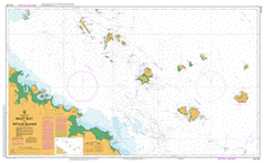
AUS 251
Bailey Islet To Repulse Islands
Please note that all charts are nominally folded in half for storage and handling as per the marine industries standard.
If you require an unfolded copy (ie: flat for framing), please select Flat Paper, and we will organise a special print service to accomodate your request.
Description
This official Nautical Chart is produced by the Australian Hydrographic Office, and corrected fortnightly to 'Notice to Marines' by Cairns Charts & Maps. This ensures it remains compliance with Safety of Navigation requirements. This marine chart, or 'sea map', is primarily produced to support the safe navigation of commercial shipping through Australian, Papua New Guinea and Solomon Island waters.
Nautical charts depict the seabed, or bathymetry, using a variety of colours to shade the depth regions. Darker blues indicate shallower water, while light blues and white indicate deeper water. A chart will also show continuous contour lines (at varying intervals depending on the scale of the chart), 'spot depths' across the whole area, as well as different symbols indicating wrecks, shallow rocks and dangers, as well as details on lights, light houses, tides and currents.
For extensive detail on the symbology of nautical charts, the Symbols and Abbreviations used on Admiralty Charts is the definitive reference.
Bucasia Eimeo Seaforth Shoal Point St Helens Beach Haliday Bay Ball Bay Acacia Island Mount Adder Allonby Island Amhurst Creek Anchor Islands Anchorsmith Island Andrews Point Anvil Island Aspatria Island Bailey Islet Barrow Hill Bashfords Landing Baxendell Shoal Beallah Bellows Island Bennett Rock Blackcombe Island Blacksmith Island Blackwood Shoals Mount Blackwood Bolton Shoal Brampton Island Brampton Island National Park Brothers Islands Bullion Rocks Buthurra Calder Island Cape Hillsborough National Park Careys Creek Carlisle Island Carondelet Rock Carpet Snake Island Carpet Snake Point Cattle Bay Cave Island Clanside Cluny Creek Cockermouth Island Cod Point Coffin Island Conow Creek Constant Creek Coppersmith Rock Cramer Point Croaker Rock Cumberland Channel Denmans Creek Devereux Rock Dewars Beach Dewars Point Dolphin Heads Dorsal Rock Downfall Creek East Repulse Island Echo Point Edgell Rock Egremont Pass Eimeo Creek Fantome Rocks Farrier Island Flimby Shoal Finger And Thumb Islands Finlaysons Point Fish Reef Forge Rocks Four Mile Gully Mount Gabrovo Geeberga Geranium Shoal Goat Bay Goldsmith Island Green Island Habana Hammer Island Hansens Gully Helvellyn Rocks Hempel Rock Hesket Rock High Islands Hillsborough Channel Cape Hillsborough Home Creek Homestead Bay Hornet Gully Hutchison Shoal Hyde Rock Ingot Ingot Islets Io Reef Jane Creek Jolimont Creek Joseph Bay Jukes Creek Mount Jukes Keswick Island Kitty Creek Kuttabul Ladysmith Island Leila Creek Mount Lewis Linne Island Llewellyn Shoal Locksmith Island Lonely Bay Low Rock Macartney Creek Macartneys Gap Macartneys Landing Mackay Point Macquarie Creek Martin Creek Maryport Bay Maryport Island Mathers Landing Mausoleum Island McBrides Point Mount McLean Mount Jukes East Mount Ossa Murray Creek Murrinda Mystery Creek Narpi Neilson Creek Newry Island Newry Islands National Park Port Newry Niddoe Creek Niddoes Gap Nine Mile Creek Nobbler Creek North Red Cliff Island One Mile Creek Orphanage Swamp Osprey Point Ossa Ossa Creek Outer Newry Island Paget Creek Palm Bay Palm Tree Creek Pandamus Gully Pelican Island Penny Bay Pigeon Island Pincer Island Pinnacle Rock Plantation Creek Rabbit Island Raspberry Creek Red Cliff Islands Refuge Bay Reliance Creek Relief Point Repulse Islands Revenge Creek Rocky Island Rocky Mountain Ross Smith Bank Mount Roy Sand Bay Sandfly Creek Scawfell Island Schooner Rock Seaforth Creek Silloth Rocks Silversmith Island Singapore Rock Sir James Smith Group Skiddaw Peak Skull Knob Slippanel Creek Small Creek Smalleys Beach Solder Island South Red Cliff Island South Repulse Island Southern Point Specie Shoal Pioneer Peaks National Park Spring Creek Mount Springcliffe St Bees Head St Bees Island St Helens Bay St Helens Creek Steff Rock Stewart Peninsula Stone Island Sunset Bay Surprise Creek Mount Sweetland Swordfish Point Ten Mile Creek The Pinnacle Three Mile Creek Tinsmith Island Tramrail Gully Turkey Creek Turtle Bay Turtle Point Victor Creek Vincent Bay Wedge Island Western Point Whale Bay Wigton Island Williamsons Beach Wool Bay Mount Xeromero Belmunda Beach Mount Ossa National Park Reliance Creek National Park Skull Knob Conservation Park Smith Islands National Park South Cumberland Islands National Park Belmunda Repulse Islands National Park Neils Beach Cumberland Islands Solder Islet Coffin Islet Finger and Thumb Maryport Islet Maryport Islands Stewart Peninsular The Brothers Devereux Rocks Crooker Rock Saint Helens Beach Wootaroo Saint Helens Bay Fantome Rock Duddon Point Acacia Islet Saint Helens Creek Hallidays Bay Egremont Passage Springcliff Saint Helens Horseshoe Bend Pandanus Gully Mount Springcliff Mount Springfield Pinnacle Peak Saint Bees Island Mount Pelion Wheatley Shoal Filmoy Shoal Hesketh Rock Mount Miller Landing Creek Hunt Shoal Double Mountain Habana Creek Ehsmanns Gap Bailey Island Parapi Station Neilsen Creek Habana Mill Seaview Etowri Oom Shoal