
AUS 249
Approaches To Hay Point And Mackay
Please note that all charts are nominally folded in half for storage and handling as per the marine industries standard.
If you require an unfolded copy (ie: flat for framing), please select Flat Paper, and we will organise a special print service to accomodate your request.
Description
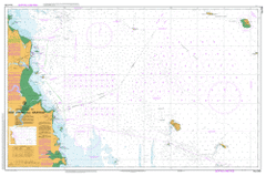
This official Nautical Chart is produced by the Australian Hydrographic Office, and corrected fortnightly to 'Notice to Marines' by Cairns Charts & Maps. This ensures it remains compliance with Safety of Navigation requirements. This marine chart, or 'sea map', is primarily produced to support the safe navigation of commercial shipping through Australian, Papua New Guinea and Solomon Island waters.
Nautical charts depict the seabed, or bathymetry, using a variety of colours to shade the depth regions. Darker blues indicate shallower water, while light blues and white indicate deeper water. A chart will also show continuous contour lines (at varying intervals depending on the scale of the chart), 'spot depths' across the whole area, as well as different symbols indicating wrecks, shallow rocks and dangers, as well as details on lights, light houses, tides and currents.
For extensive detail on the symbology of nautical charts, the Symbols and Abbreviations used on Admiralty Charts is the definitive reference.
Campwin Beach Blacks Beach Bucasia Eimeo Grasstree Beach Half Tide Beach Hector Mackay Sarina Sarina Beach Grasstree Alligator Creek Andergrove Apsley Creek Bailey Islet Bakers Creek Bally Keel Barnes Creek Bassett Basin Bassett Creek Mount Bassett Bell Creek Bells Creek Beverley Mount Blarney Breens Creek Cabbage Tree Creek Castrades Inlet Mount Chelona Mount Convenient Coral Point Cremorne Cullen Island Cullen Reef Dalrymple Bay Dalrymple Loop Dangerous Reef Dawlish Deception Inlet Deep Creek Derwent Island Dolphin Heads Double Island Downward Patches Dudgeon Ledge Dudgeon Point Dunnrock East Point Eimeo Creek Fishermans Point Flat Top Island Freshwater Point Fursden Creek Goosepond Creek Grendon Creek Mount Griffiths Mount Haden Half Tide Hay Point Hay Point Harbour Hay Point Port Hay Reef Mount Hector Highwater Island Howard Hutchison Shoal Illawong Jack Rock Jackson Creek Kemmis Lamberts Beach Leeper Reef Llewellyn Shoal Lloyd Shoal Louisa Creek Mackay Harbour McCreadys Creek McEwens Beach Mick Ready Beach Mick Ready Creek Muddy Creek North End Reef North Mackay Oom Shoal Mount Oscar Outer Harbour Overfall Rock Oyster Point Oyster Rock Paget Penrith Island Perpetua Point Pioneer River Plane Creek Plane Creek West Mount Pleasant Praguelands Prudhoe Channel Prudhoe Island Prudhoe Shoal Quarry Hill Raspberry Hill Ready Gully Recife Point Reichelmann Rock Reid Island Renou Islet Rocky Point Round Top Island Point Salisbury Salonika Beach Saltwater Creek Mount Samourgassi Sandfly Creek Sandringham Bay Sandringham Creek Sandy Creek Sarina Inlet Skull Rock Slade Island Slade Bay Slade Point Slade Rock Snare Peak Island South Mackay South Overfall Rock Splitters Creek Sunset Bay Taroba Rock The Goose Ponds Iluka Trigla Rock Victor Island Point Victor Vines Creek Viscount Shoals West Mackay Zelma Bakers Creek Conservation Park Mount Blarney Conservation Park Mount Hector Conservation Park Alligator Creek Sarina Shire Armstrong Beach East Mackay Rural View Beaconsfield Mount Pleasant Mackay City Round Top Island National Park Sandringham Bay Conservation Park Hunt Shoal Shoal Point Bailey Island Seaview Eimeo Road Amhurst Oyster Island Forgan Smith Point Bagley Point Mackay Outer Harbour Devils Elbow Vine Creek Mackay West Victoria Park Town Beach South Head North Head Paget Junction South West Spit Far Beach Port of Mackay Baker Creek Splinters Creek Mount Samourgass The Green Hole Victor Hills Chelona Hill Renou Island