
AUS 246
Approaches To Gladstone
Please note that all charts are nominally folded in half for storage and handling as per the marine industries standard.
If you require an unfolded copy (ie: flat for framing), please select Flat Paper, and we will organise a special print service to accomodate your request.
Description
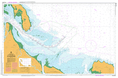
This official Nautical Chart is produced by the Australian Hydrographic Office, and corrected fortnightly to 'Notice to Marines' by Cairns Charts & Maps. This ensures it remains compliance with Safety of Navigation requirements. This marine chart, or 'sea map', is primarily produced to support the safe navigation of commercial shipping through Australian, Papua New Guinea and Solomon Island waters.
Nautical charts depict the seabed, or bathymetry, using a variety of colours to shade the depth regions. Darker blues indicate shallower water, while light blues and white indicate deeper water. A chart will also show continuous contour lines (at varying intervals depending on the scale of the chart), 'spot depths' across the whole area, as well as different symbols indicating wrecks, shallow rocks and dangers, as well as details on lights, light houses, tides and currents.
For extensive detail on the symbology of nautical charts, the Symbols and Abbreviations used on Admiralty Charts is the definitive reference.
Tidalmaree Edwards Clifton Farm Tannum Sands Benaraby Bangalee Boyne Boyne Island Boyne River Bray Hills Bushy Island Canoe Point Casuarina Clump Cattle Creek Centre Creek Creek Rocks Curtis Rock Port Curtis East Banks East Point East Point Ledge Entrance Ledge Ethel Rock Facing Channel Facing Island Flora Point Gatcombe Gatcombe Channel Gatcombe Head Greens Creek Hummock Hill Iveragh Jenny Lind Bank Lilly Hills Machine Creek Manning Reef Manns Gap Mort Creek North Bank North Channel Observation Point Oyster Rock Parsons Point Pearl Ledge Pelican Banks Richards Point Rocky Point Rodds Bay Rodds Peninsula Sable Chief Rocks Seal Rocks Settlement Point She Oak Island Shoal Bay South Channel South Trees South Trees Island South Trees Point Station Creek Tiber Point Wapentake Creek West Banks Wild Cattle Beach Wild Cattle Creek Wild Cattle Island Wurdong Creek Wurdong Hill Boyne Island Conservation Park Wild Cattle Island National Park Bushy Islet South Trees Anchorage South Trees Wharf South Trees Inlet South Tree Inlet East Bank Port of Gladstone South Entrance Red Cliff Creek Ethel Rocks Wurdong Rodd Bay Tongue Spit