
AUS 14
Groote Eylandt
Please note that all charts are nominally folded in half for storage and handling as per the marine industries standard.
If you require an unfolded copy (ie: flat for framing), please select Flat Paper, and we will organise a special print service to accomodate your request.
Description
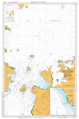
This official Nautical Chart is produced by the Australian Hydrographic Office, and corrected fortnightly to 'Notice to Marines' by Cairns Charts & Maps. This ensures it remains compliance with Safety of Navigation requirements. This marine chart, or 'sea map', is primarily produced to support the safe navigation of commercial shipping through Australian, Papua New Guinea and Solomon Island waters.
Nautical charts depict the seabed, or bathymetry, using a variety of colours to shade the depth regions. Darker blues indicate shallower water, while light blues and white indicate deeper water. A chart will also show continuous contour lines (at varying intervals depending on the scale of the chart), 'spot depths' across the whole area, as well as different symbols indicating wrecks, shallow rocks and dangers, as well as details on lights, light houses, tides and currents.
For extensive detail on the symbology of nautical charts, the Symbols and Abbreviations used on Admiralty Charts is the definitive reference.
Alyangula Angurugu Abarungkwa Beach Alubuwa Point Alyangula Area School Alyangula Golf Club Alyangula Health Centre Alyangula Police Station Alyangula Pre School Alyangula Ridge Alyangula School and Community Library Alyinga Island Amagbirra Island Amagiladjura Point Amalyikba River Andungwa Creek Angamanja Island Angarmbulumardja Island Angarumurada Island Angurugu Creek Angurugu Health Centre Angurugu Pre School Angurugu School Anindilyakwa Arawura Bay Arnarrama Creek Arrumanja Creek Arruwa Island Ayarina Bay Bardalumba Bartalumba Bay Brady Rock Burley Shoal Burney Island Burns Shoal Burriyangumurrumanja Creek Bustard Island Bustard Isles Cape Shield Central Hill Chasm Island Chasm Shoal Connexion Channel Connexion Island Darrangmurmanja Deception Bay Dirrangmurumanja Bay East Bay Endungwa Beach Enikarrnga Swamp Eningkirra Beach Enumerrmanja Point Finch Island Gooninnah Island Groote Eylandt Groote Eylandt Airport Hand Islet Hawknest Island Ilyaugwamaja Island Larrembijanga Island Lewrrumbumanja Cliff Lyangbudumanja Point Makbumanja Point Malgala Creek Malkala Mamarmbawiya Point Mamarringarrimanja Swamp Manggarna Island Marjirrumanja Beach Mekubarrkumanja Point Menimberrkwe Cliff Milner Bay Milyema Island Mugwana Island Mundarringumanja Beach Mundarrungmundja Ngadumiyerrka Nicol Island North West Bay North West Bluff Nulukwa Bay Numbarrila Beach Rutland Shoal Warwick Channel Wedge Rock Winchelsea Island Winchelsea Passage Winchelsea Rock Wurrwebuweba Point Yarranya Island Yellow Patch Yelyukwumanja Beach Yingilirrba Island Yirrumanja Point Nicols Island Nicols Islet Burney Islet Chasm Islet Marble Point Finch Islet Winchilsea Island Marjirrumanja Beach Anarrama Creek Connexion Islet Mount Ellie Ritland Shoal