
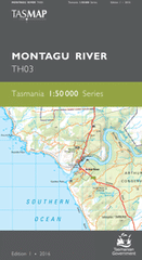
TAS TH03
Montagu River
Digital Products: You will be forwarded a copy of your digital product via email the following business day.There are no automatic download services available for Tasmap digitial products.
Digital Limitations: Please note that the digital version of these maps DO NOT contain borders, legends, scales, etc. Where a product covers multiple areas, each area is provided as a seperate file. These may not be suitable for use as a print product.
Description
This Topographic Map is produced by the Department of Primary Industries, part of the Tasmanian Government.
These maps are an important resource for Government, industry, and the public. They are used for environmental and emergency management, farm planning and mineral exploration. They are also popular for recreational users such as bushwalkers, mountain bike and horse riders.
The PDF version of this can be printed at home or sent to a professional printer for a 100% scale reproduction.
At this scale, 2cm on this map represents 1km on the ground. A standard map (which is square) covers an area of approximately about 25km by 25km, with a contour interval of 10m. This map contains natural and constructed features including road and rail infrastructure, vegetation, hydrography, contours, localities and some administrative boundaries.
Poverty Knob Mowbray Park Greenhorns Fonthill Greenacres Midway Paringa Akkervoorde Arthur River Adelaide Creek Alert Creek Allen Creek Ann Bay Drive Creek Dry Dog Creek Duck River Duck River Conservation Area Duck River East Conservation Area Duffs Flat Eagle Rock Arthur River Bridge Australia Point Bellas Hole Big Bend Birthday Creek Black Bull Scrub Black Rocks Blackwood Bridge Blue Bog Bluff Hill Bluff Hill Lighthouse Bluff Hill Point Boggy Creek Bond Tier Bowood Hill Brittons Hill Brittons Swamp Broadmeadows Brooks Ridge Bucketty Flat Callaghans Scrub Christmas Hills Church Rock Coffeys Hill Coles Lookout Coronation Creek Croles Hill Cuffys Creek Cyathea Creek Dismal Swamp Dismal Swamp Nature Reserve Dobson Creek Doctors Creek Edith Creek Ekberg Creek Elver Falls Fairview Hill Farnhams Creek Fentons Creek Fixters Creek Fourteen Mile Plain Green Point Green Point Beach Green Point Lagoon Green Point Reef Greenes Creek Greys Creek Galeford Creek Gales Bay Gardiner Point Geales Creek Hays Tier Home Creek Hopeless Plains Jim Crowe Scrub Jims Plain Johnsons Creek Jones Plain Junction Plain Kings Hill Langford Creek Leesville Lighthouse Beach Lobster Creek Lovells Creek Marrawah Mawson Bay Maxies Point McDonald Creek Mella Mill Creek Montagu Plains Montagu River Montagu River Conservation Area Montagu Swamp Montagu Swamp Conservation Area Moores Creek Mortyns Hill Mount Cameron Beach Mount Cameron West Mowbray Swamp Myhill Creek Nettley Bay Nimble Creek Nineteen Mile Hill Pavement Point Periwinkle Beach Plains Creek Popowski Creek Port Hills Prickly Wattle Lagoon Pykes Creek Rainbow Hill Red Creek Redpa Redpa Hill Richardsons Creek Richardsons Flats Rock of Ages Roger River Roger River Conservation Area Roger River Road Conservation Area Roger River State Reserve Roger River West Rusty Rock Salmon River Sawards Creek Seventeen Mile Plain Seymour Hill Shell Creek Sinking Rock Sky Creek Slaves Bay Slaves Bay Conservation Area Smithton Smithton Golf Course South Downs Spinks Creek Station Hill Stinkhole Styx Creek The Kick Thorpes Plain Togari Toomey Creek Tram Creek Trowutta Trowutta Station Victor Creek Waratah Plain Warra Creek Watsons Bend Welcome River Welcome Swamp Wells Creek West Point West Point State Reserve Whelans Creek White Water Creek Williamsons Creek Woodside Creek Benders Hill Bond Tier Forest Reserve Camp Creek Church Cove Dismal Swamp Forest Reserve Fagans Flying Camp Greenes Hill Kings Run Private Nature Reserve Limestone Creek Lovells Creek Forest Reserve Montagu River Bridge Montagu River Forest Reserve Montagu Swamp Forest Reserve Plains Creek Forest Reserve Red Hill Red Rock Roger River Scenic Reserve Sand Hill The Rock Trowutta Hill Warra Creek Forest Reserve Welcome River Bridge Welcome Swamp Forest Reserve Montague Swamp Salmon River Siding Sherstons Hill Bluff Head Point Bluff Point Buff Hill Point Frankland River