
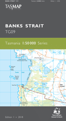
TAS TG09
Banks Strait
Digital Products: You will be forwarded a copy of your digital product via email the following business day.There are no automatic download services available for Tasmap digitial products.
Digital Limitations: Please note that the digital version of these maps DO NOT contain borders, legends, scales, etc. Where a product covers multiple areas, each area is provided as a seperate file. These may not be suitable for use as a print product.
Description
This Topographic Map is produced by the Department of Primary Industries, part of the Tasmanian Government.
These maps are an important resource for Government, industry, and the public. They are used for environmental and emergency management, farm planning and mineral exploration. They are also popular for recreational users such as bushwalkers, mountain bike and horse riders.
The PDF version of this can be printed at home or sent to a professional printer for a 100% scale reproduction.
At this scale, 2cm on this map represents 1km on the ground. A standard map (which is square) covers an area of approximately about 25km by 25km, with a contour interval of 10m. This map contains natural and constructed features including road and rail infrastructure, vegetation, hydrography, contours, localities and some administrative boundaries.
Cape Portland East Bank Banks Strait Baynes Island Baynes Island Nature Reserve Cape Portland Conservation Area Charmouth Hill Cockle Bank Cuckoo Creek Cygnet Island Dark Hollow Foster Inlet Foster Islands Foster Islands Nature Reserve Great Musselroe Bay Harry Rock Home Beach Jetty Bay Ladys Bay Lambs Creek Lanoma Point Lemons Beach Lemons Creek Lighthouse Point Lighthouse Point Conservation Area Little Musselroe Bay Little Musselroe River Little Swan Island Little Swan Island Nature Reserve Lookout Head Low Islets Low Islets Nature Reserve Lyme Regis Mack Rocks MacLean Island Mexican Hill Moriarty Bank Moriarty Bay Moriarty Point Moriarty Rocks Moriarty Rocks Nature Reserve Mussel Rock Musselroe Bay Conservation Area Musselroe Point Petal Point Quakers Plain Rebecca Bay Ringarooma Tier Semaphore Hill South Head Swan Island Swan Island Lighthouse Tebrakunna Bay Telegraph Bay Three Mile Hill Tree Point Tregaron Lagoons West Bay Cemetery Lagoon Charmouth East Boat Harbour Lemons Boat Harbour Musselroe Lagoon Portland Hill Sand Patch Tregaron West Boat Harbour Lookout Heads Great Mussel Roe River