
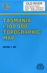
TAS 8111
Old River
Digital Products: You will be forwarded a copy of your digital product via email the following business day.There are no automatic download services available for Tasmap digitial products.
Digital Limitations: Please note that the digital version of these maps DO NOT contain borders, legends, scales, etc. Where a product covers multiple areas, each area is provided as a seperate file. These may not be suitable for use as a print product.
Description
This Topographic Map is produced by the Department of Primary Industries, part of the Tasmanian Government.
These maps are an important resource for Government, industry, and the public. They are used for environmental and emergency management, farm planning and mineral exploration. They are also popular for recreational users such as bushwalkers, mountain bike and horse riders.
The PDF version of this can be printed at home or sent to a professional printer for a 100% scale reproduction.
At this scale, 1cm on this map represents 1km on the ground. A standard map (which is square) covers an area of approximately 54km by 54km, with a contour interval of 20m. This map contains natural and constructed features including road and rail infrastructure, vegetation, hydrography, contours, localities and some administrative boundaries.
Claytons Melaleuca Abscida Falls Airstrip Rise Aladdin Bay Alexander Creek Alpha Moraine Amita Creek Anne Gorge Anne River Dorado Peak Dorado Ridge Dragonfly Lake Dutchman Creek Earl Lake East Portal Eastern Arthur Range Edgar Dam Edgar Dam Camping Ground Edgar Pond Arthur Plains Aylen Point Bakers Ridge Balmoral Beach Balmoral Hill Bathurst Channel Bathurst Creek Bathurst Harbour Bathurst Narrows Bathurst Range Beattie Creek Bechervaise Plateau Beggary Bumps Bell Creek Big Guardian Billiarchi Creek Black Cliff Black Cliff Hills Black Swan Island Blandfordia Rock Boiler Plates Border Hill Bramble Cove Branson Point Breakspeare Creek Brock Mount Buoy Creek Burke Creek Capella Crags Carina Peak Casilda Cove Celery Top Islands Centaurus Ridge Cerberus Hill Charlies Hill Cherry Creek Chink Point Chockstone Gully Cinder Hill Claytons Corner Clytie Cove Collins River Cone Rock Corner Peak Cox Creek Cracroft Crossing Cracroft Plains Cracroft River Crags Of Andromeda Critchley Creek Crossing Plains Davey Sugarloaf Deep Point Dendron Creek Devils Thumb Divaricate Creek Dividing Valley Dixon Island Dodds River Dohertys Ground Eds Cove Elbow Creek Epsilon Moraine Erskine Range Eve Point Fairytale Head Faraway Creek Farrell Point Federation Peak Flying Cloud Point Folded Range Foley Creek Foley Pimple Forest Hills Forest Lagoon Forrester Point Four Peaks Frankland River Freney Lagoon Frogs Hollow Green Head Greystone Bluff Fulton Cove Fulton Creek Geeves Bluff George Creek Giblin Bay Gita Creek Glovers Pass Goon Moor Gorge Creek Gorge Ridge Gorilla Ridge Goring Creek Guardian Creek Gull Reef Half Woody Hill Hammond Point Hanging Lake Harrys Bluff Haven Lake Heather Hill Hedgerow Creek Hehir Island Helby Point Herrirud Creek Hidden Valley High Moor High Round Mountain Hoare Creek Hope Tarn Hopetoun Creek Hopetoun Gorge Horseshoe Creek Horseshoe Inlet Huon Basin Huon River Camping Ground Ila Bay Iola Bay Ironbound Range Island Bay Joan Point Joe Page Bay Jones Pass Junction Creek Junction Ridge Kappa Moraine Kellatie Creek Kings Knob Knight Creek Kroanna Hill Lake Ariel Lake Bewsher Lake Callisto Lake Ceres Lake Cracroft Lake Cygnus Lake Dione Lake Eucryphia Lake Fortuna Lake Ganymede Lake Gaston Lake Geeves Lake Juno Lake Jupiter Lake Leo Lake Maconochie Lake Mars Lake Mercury Lake Mimas Lake Miranda Lake Neptune Lake Nereid Lake Oberon Lake Payens Lake Pluto Lake Ron Smith Lake Rosanne Lake Saturn Lake Shaw Lake Sirona Lake Titania Lake Triton Lake Uranus Lake Venus Lake Vesta Landing Point Laughing Creek Lees Knob Lenna Creek Lindsay Hill Little Cinder Hill Little Guardian Little Louisa Islet Loaparte Cove Lomatia Falls Lone Hill Lost World Plateau Louisa Creek Louisa River Lucifer Ridge Luckmans Lead Luttrell Creek Manwoneer Inlet Margaret Creek May Point McKays Point Melaleuca Creek Melaleuca Inlet Melaleuca Lagoon Melaleuca Range Miller Lagoon Moinee Ridge Monga Creek Moraine Tarn Mosquito Creek Moss Ridge Moth Creek Moulter Creek Moulters Gap Moulters Inlet Mount Aldebaran Mount Beattie Mount Berry Mount Braddon Mount Canopus Mount Capricorn Mount Castor Mount Columba Mount Counsel Mount Curran Mount Fulton Mount Giblin Mount Hayes Mount Hesperus Mount Hopetoun Mount Jim Brown Mount King Mount Legge Mount Louisa Mount MacKenzie Mount Maconochie Mount Melaleuca Mount Nares Mount Nicholls Mount Norold Mount Orion Mount Parry Mount Pegasus Mount Piguenit Mount Pollux Mount Rallinga Mount Robinson Mount Rugby Mount Scorpio Mount Shaula Mount Sirius Mount Stokes Mount Taurus Mount Wilson Munday Island Navaho Creek New Falls Creek New Harbour Range New River Ngyena Creek Night Islet Nine Mile Creek Nixson Point Noon Point Norold Creek North Inlet North River Old River Opossum Creek Opossum Point Pandora Hill Parker Bay Pasco Creek Pasco Range Pass Creek Passage Creek Pauline Point Pender Creek Pim Point Pine Creek Platypus Point Poimena Hills Point Eric Procyon Peak Promontory Lake Provis Hills Purdon Creek Quartz Bound Hill Race Creek Raphael Creek Ration Creek Rattenbury Hill Ravine Creek Ray Range Ray River Red Knoll Red Tape Creek Reward Claim Creek Richea Peak Ripple Mountain Rowitta Harbour Rowitta Plains Rugby Range Schnells Ridge Schooner Cove Scoparia Head Scotts Peak Scotts Peak Dam Scrubby Peak Sculptured Mountain Seven Mile Creek Skew Falls Smith Creek Smiths Tarn Solly River South West Cape Range Southwest National Park Spica Hills Spiro Range Spring River Square Lake Starvation Bay Sticht Hills Stonehenge Peak Strike Creek Strike Gorge Strike Ridge Stuart Saddle Swan Cove Tanah Hill Tannin Creek Tea Tree Cove The Dial The Dragon The Gables The Phoenix The Razorback The Sculptor Thwaites Plateau Tilted Chasm Trixies Cove Two Mile Creek Umbra Creek Umbrose Creek Watts River Wayeninnah Hill West Portal Western Arthur Range White Monolith Range White Point White Solly Creek Window Pane Bay Window Pane Creek Wombat Peak Woureddy Bay Woureddy Creek Wullyawa Creek Big Beggary Big Counsel Box Creek Bratts Creek Bratts Pass Counsel Creek Cutting Camp Fault Creek Flagstaff Hill Georges Falls Huon Gorge Junction Creek Airstrip Little Beggary Marble Towers Norold Mountains Papworth Creek Port Davey Secret Amphitheatre Sphinx Rock Survey Platform Swan Island The Needles White Rock Huon Plains Lake Edgar Hardwood River Crags of Andromeda Roy River