
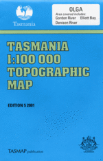
TAS 8012
Olga
Digital Products: You will be forwarded a copy of your digital product via email the following business day.There are no automatic download services available for Tasmap digitial products.
Digital Limitations: Please note that the digital version of these maps DO NOT contain borders, legends, scales, etc. Where a product covers multiple areas, each area is provided as a seperate file. These may not be suitable for use as a print product.
Description
This Topographic Map is produced by the Department of Primary Industries, part of the Tasmanian Government.
These maps are an important resource for Government, industry, and the public. They are used for environmental and emergency management, farm planning and mineral exploration. They are also popular for recreational users such as bushwalkers, mountain bike and horse riders.
The PDF version of this can be printed at home or sent to a professional printer for a 100% scale reproduction.
At this scale, 1cm on this map represents 1km on the ground. A standard map (which is square) covers an area of approximately 54km by 54km, with a contour interval of 20m. This map contains natural and constructed features including road and rail infrastructure, vegetation, hydrography, contours, localities and some administrative boundaries.
Abel Gorge Abels Creek Albert River Allan Knight Power Station Angel Cliffs Double Fall Drake Creek Badger Ridge Barrel Creek Big Beach Big Eddy Big Fall Blackmans Bend Bradleys Hill Brown Hill Butler Island Butler Rivulet Camerons Flat Cataract Creek Charles Range Clinnelare Cave Conder River Condominium Cliffs Connellys Creek Connellys Falls Convict Peak Cowrie Beach D'Aguilar Range Deenareena Cave Denison Gorge Detached Peak Devils Teapot Dismal Creek Dohertys Range Dolphin Ridge Elliott Bay Elliott Hill First Split Franklin Eddy Franklin River Franklin Rock Frederick Hill Freedoms Gate Granite Point Galleon Bluff Ghost Creek Gordon Dam Goulds Landing Grining Creek Grinings Landing Hales River Hamilton Range Hardwood Hill Hardwood River Harrison Creek Hazell Hill Howards Creek Hudson River Innes Peak Intake Bay Islet Lake Jakerloo Creek Jones Mistake King Billy Range Kinghorn Creek Knob Basin Koruna Peak Kutikina Cave Lake Fidler Lake Wilmot Lancelot Hill Lancelot Rivulet Lawn Creek Lawson Range Limestone Creek Little Percy Creek Little Rocky River Lower Sprent Falls Lowgernown Creek Mainwaring River Marble Cliffs Marriotts Gorge Maxwell River Middle Ground Moores Landing Moores Lookout Moores Valley Mount Discovery Mount Eleanor Mount Humboldt Mount Jean Mount Lee Mount Lewis Mount Osmund Mount Robert Mount Sprent Myrtle Creek Neils Tunnel Nicholls Range North Broken Hills Nothofagus Cave Olegas Bluff Olga River Orange River Pass Hill Peaceful Creek Pengana Cave Perched Lake Percy River Piguenit Rivulet Platypus Creek Princess Range Propsting Range Pyramid Island Que River Razor Ridge Review Hill Reynolds Creek Roaring Creek Rocky Sprent Falls Rookery Plain Ropeway Creek Rosslyns Pool Rotuli Cave Sandstone Creek Sassy Creek Sceptre Lake Seal Rapid Second Split Serpentine Dam Serpentine Gorge Serpentine River Sharks Mouth Rapid Shingle Island Sir John Falls Smith River Snag Point Snake Rapids South Broken Hills Spero River Sprent Basin Sprent River Starfish Inlet Stony Creek Stranger Creek Sulphide Pool Sunshine Falls Sunshine Gorge Table Top The Bell The Knob The Twins Thirkell Hill Top Plain Tribulation Ridge Truchanas Huon Pine Forest Turner Creek Verandah Cliffs Verandah Creek View Hill Wallaby Eddy Wanderer River Warners Creek Warners Landing Wart Hill Waterloo Creek Wilmot Range Wooloomooloo Creek Albert Rapids Artefact Creek Devils Hole Dianas Basin Gordon Splits Lower Split Mount Yopyop Plomley Rivulet Pophole Princes Peak Round Hill Sprent Falls The Gorge The Pophole Truchanas Huon Pine Reserve Upper Split Forester Rivulet Princess Rivulet Foucha Creek Butler Creek DAguilar Range Little Percy Sprent Creek Percy Sprent Creek Percy Sprent River Albert Creek Junction Range North Broken Hill Lewis River Big Beach Point Elliot Cove Elliott Cove Low Rocky Point Elliott Point Elliot Hill