
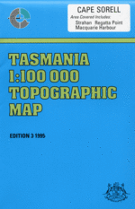
TAS 7913
Cape Sorell
Digital Products: You will be forwarded a copy of your digital product via email the following business day.There are no automatic download services available for Tasmap digitial products.
Digital Limitations: Please note that the digital version of these maps DO NOT contain borders, legends, scales, etc. Where a product covers multiple areas, each area is provided as a seperate file. These may not be suitable for use as a print product.
Description
This Topographic Map is produced by the Department of Primary Industries, part of the Tasmanian Government.
These maps are an important resource for Government, industry, and the public. They are used for environmental and emergency management, farm planning and mineral exploration. They are also popular for recreational users such as bushwalkers, mountain bike and horse riders.
The PDF version of this can be printed at home or sent to a professional printer for a 100% scale reproduction.
At this scale, 1cm on this map represents 1km on the ground. A standard map (which is square) covers an area of approximately 54km by 54km, with a contour interval of 20m. This map contains natural and constructed features including road and rail infrastructure, vegetation, hydrography, contours, localities and some administrative boundaries.
Strahan Albina Creek Albina Rock Alma Point Double Cove Dunes Creek East Sister Asbestos Point Back Channel Backagain Point Baylee Creek Beehive Creek Betsys Bay Birchs Beach Birchs Narrows Bird Islets Birthday Bay Birthday Creek Blackwood Creek Bonnet Bay Bonnet Island Botanical Creek Bottle Creek Bowra Rock Braddon Point Braddon River Briggs Creek Bryans Bay Buoy Point Burgess Rivulet Butler Creek Butt Of Liberty Camp Point Camp Spur Cape Sorell Cape Sorell Historic Site Cape Sorell Lighthouse Cat Island Channel Bay Channel Hill Charleys Beach Cliffords Creek Coal Head Commandant Creek Connellys Point Connellys Point Creek Cosy Corner Cradle Creek Cuthbertson Creek Cutten Creek Darktown Bay Dart Point Davis Bay Dead Horse Point Defriez Bay Dingy Point Discovery Beach Edwards Bay Elizabeth Island Entrance Island Entrance Rock Fabritong Rivulet Farm Cove Fern Creek Fleabite Creek Four Mile Creek Fouscha Creek Fraser Flats Grandfathers Beach Gravelly Creek Geologist Creek Goat Hill Gordon Point Gorge Creek Gorge Point Gorings Creek Gould Point Grummet Island Hallidays Island Halls Creek Hannants Bight Harveys Creek Hawks Nest Cove Hells Gates Henrietta Creek Henry Point Henty Bridge Henty Dunes Henty River Heron Pond Hills Creek Hogan Cove Hogarth Falls Horsetrough Creek Hospital Creek Iron Creek Karitane Rock Karnebunyer Creek Kawatiri Shoal Kelly Channel Kelly Gully Kidney Cove King Point King River Kingfisher Creek Koyule Flat Lagoon Creek Lake Ashwood Lake Bantick Lake Bellinger Lake Garcia Lake Koonya Lake Mallanna Lake Strahan Landing Creek Lettes Bay Liberty Bay Liberty Creek Liberty Point Lignite Creek Lilaree Creek Little Bellinger Little Tully River Lodders Lookout Lode Creek Long Bay Lost Creek Lowana Point Lower Landing Creek Lucas Creek Lucas Point Lucky Creek Macquarie Harbour Macquarie Harbour Historic Site Macquarie Heads Macquarie Heads Camping Ground Magazine Island Magazine Point Magazine Point Conservation Area Malcolm Creek Manuka River Marchfly Ridge McCutcheons Creek Melody Creek Middle Sister Mill Bay Minx Point Misery Flat Modder River Morse Bay Mosquito Cove Mount Antill Mount Lyell Railway Mount Obvious Muddy Cove Muddy Cove Creek Murderers Beach Napier Hills Neck Island Nielsen River Nigger Head Noddy Creek Ocean Beach Ocean Beach Conservation Area Olsen Reef Open Creek Pearl Creek Pebbly Beach Peevers Creek Pelias Cove Pelican Spit Peoples Park Philips Island Piccaninny Point Pilot Bay Pilot Beach Pine Corner Pine Cove Pine Cove Creek Pine Cove Point Pine Point Porteus Creek Prater Rock Professor Plateau Purdys Creek Quail Creek Regatta Point Richardsons Bay Rinadeena Saddle Risby Cove River Point Round Head Rum Point Sailor Jack Creek Sand Dunes Picnic Ground Sarah Island Schofield Creek Shag Islands Shamrock Point Signal Point Skeeter Creek Sloop Point Smith Cove Soldiers Island Sophia Point Split Rock Spur Point Starting Creek Steadman Beach Steadman Point Strahan Aerodrome Strahan Customs House Historic Site Strahan Golf Course Strahan Harbour Strahan Plantation Strahan Point Sulphide Creek Surging Point Swan Basin Swan Basin Picnic Ground Swan Basin Plantation Swift Creek Table Creek Table Head Teal Pond Teepookana The Cap The Grandfathers Tiddys Beach Tidegauge Rock Timbertops Timms Creek Trumpeter Point Trumpeter Rock Truscott Creek Tully River Tully River Conservation Area Turners Rock Varna Bay Virginia Creek Waller Creek War Memorial Park Water Tower Hill Waterfall Gully Watts Hill Wellington Head West Sister West Strahan West Strahan Beach Whale Rock Winding Creek Wooding Point Woody Hill Yellow Bluff Yolla Point Beach Road Siding Bell Hill Bellinger Siding Bird Island Bobs Bay Braddon Bay Centre Hill Fowlers Siding Gate Hill Henty Forest Reserve Henty Siding Koyule Siding Lowana Mallanna Manuka Creek Bridge Murderers Cave Nelson River Old Strahan Outer Bay Pine Creek Rinadeena Rock Island Sloop Rocks Stella Siding Store Island Teepookana Forest Reserve The Sisters Twin Islands Fowlers Koyule Sisters Langdon River Henty Yolande River Bellinger South Branch Tully River Stella Manuka Creek Lette Bay Teepookana Siding Starling Creek Cape Sorrell Bonnet Islet Shag Island Betsey Island Betsy Island Clark River Philip Island Settlement Island Big Creek Birch Inlet Birches Inlet