
TAS 7815
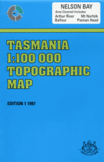
Nelson Bay
Digital Products: You will be forwarded a copy of your digital product via email the following business day.There are no automatic download services available for Tasmap digitial products.
Digital Limitations: Please note that the digital version of these maps DO NOT contain borders, legends, scales, etc. Where a product covers multiple areas, each area is provided as a seperate file. These may not be suitable for use as a print product.
Description
This Topographic Map is produced by the Department of Primary Industries, part of the Tasmanian Government.
These maps are an important resource for Government, industry, and the public. They are used for environmental and emergency management, farm planning and mineral exploration. They are also popular for recreational users such as bushwalkers, mountain bike and horse riders.
The PDF version of this can be printed at home or sent to a professional printer for a 100% scale reproduction.
At this scale, 1cm on this map represents 1km on the ground. A standard map (which is square) covers an area of approximately 54km by 54km, with a contour interval of 20m. This map contains natural and constructed features including road and rail infrastructure, vegetation, hydrography, contours, localities and some administrative boundaries.
Kaywood Arthur River Adelaide Creek Ahrberg Bay Alert Creek Driftwood Cove Dunns Plain Arthur Beach Arthur River Bridge Arthur River Conservation Area Arthur-Pieman Conservation Area Australia Point Balfour Bare Rock Barney Creek Big Bend Big Eel Creek Blackwater Rivulet Blue Lagoon Bluff Hill Bluff Hill Lighthouse Bluff Hill Point Bottle Creek Bottle Flat Brooks Creek Brooks Ridge Buckby Creek Bullocky Hill Callaghans Scrub Cassiterite Creek Chester Creek Chimney Creek Church Rock Conical Harbour Conical Rocks Point Couta Rocks Cyril Creek Dago Plains Daisy River Dark Creek Dartys Corner Dawson Bay Dawson River Deep Lagoon Dingo Flats Dohertys Pimple Eighty Creek Ekberg Creek Elver Falls Emmetts Creek Eva Point Ferry Point Foam Creek Ford Creek Four Mile Beach Four Mile Beach Regional Reserve Frankland Creek Frankland River Greenes Creek Greenes Point Gaffney Creek Gaffney Point Gales Cliffs Gannet Gulch Gannet Point Gardiner Point George Town Packet Creek Grace Creek Hardwicke Bay Hardwicke Point Hawkes Creek Hazard Bay Helen Peak High Rock Home Creek Horton River Hoyle Creek Hunters Creek Ingram Bay Italian Creek Jaegers Oxbow Johnnys Lookout Johnsons Bay Johnsons Creek Johnsons Head Julius River Kanunnah Bridge Kenneth Bay Kenneth Creek Keppel Creek Koonya Inlet Lady Kathleen Beach Lagoon River Lagunta Creek Langford Creek Leigh River Lenna Creek Lindsay River Little Eel Creek Little Frenchman Little Sundown Creek Looneys Flat Lovells Creek Mawson Bay McDougalls Lookout McLeod River Melba Creek Misery Island Monster Creek Montagu Swamp Mount Balfour Mount Edith Mount Frankland Mount Hazelton Mount Holloway Mount Judith Mount Lily Mount Mabel Mount Norfolk Murray Creek Myhill Creek Native Hut Creek Native Well Bay Nelson Bay Nelson Bay River Newdegate Creek Nimble Creek No Mans Creek Norfolk Range North Pedder River Ordnance Point Panel Creek Parallel Reef Pardoe Creek Pedder River Pieman Head Pieman River Pieman River State Reserve Pollys Bay Poppys Lagoon Possum Banks Possum Banks Lagoon Possum Creek Prickly Wattle Lagoon Prospect Hill Proudfoot Creek Rachel Creek Rebecca Creek Rebecca Lagoon Rebecca Point Richardson Point Richardsons Creek Richardsons Flats Rita Creek Rupert Point Salmon River Sandy Cape Sandy Cape Beach Sandy Cape Light Sarah Anne Rocks Sardine Creek Sawards Creek Schramms Cove Sea Devil Rivulet Sea View Hill Skinners Flat Skull Creek Sky Creek Smith Creek Smiths Gulch Specimen Hill Squealing Creek Stephens Rivulet Sumac Lookout Sundown Creek Sundown Point Sundown Point State Reserve Surprise Creek Symes Creek Temma Temma Harbour Templars Creek The Clump Thornton River Tiger Creek Tiger Flat Tikkawoppa Plateau Regional Res ... Toomey Creek Venables Corner Victor Creek Violet Rivulet Waratah Creek Warra Creek Websters Creek West Bluff Wild Wave River Woody Peak Wuthering Heights Plain Yarrana Hill Balfour Track Forest Reserve Black Rocks Breakneck Creek Camp Creek Church Cove Conical Rocks Dawson Bog Harrissons Channel Kings Run Private Nature Reserve Lobster Rocks Lovells Creek Forest Reserve Manuka Creek Monster Point Montagu River Forest Reserve Montagu Swamp Forest Reserve Mount Burley Nelson Bay River Bridge Rebecca Creek Forest Reserve Ridge River Sandy Point Shell Creek Stony Creek Sumac Forest Reserve Symes Bay Tinville Warra Creek Forest Reserve West Head Wild Wave Point Bluff Head Point Bluff Point Buff Hill Point Nelson River Whale Boat Harbour Whales Boat Harbour Richardsons Point The Little Frenchman River Leigh Ordinance Point Mount Hazleton Mount Hollway Johnson Bay Interview River Tikkawoppa Plateau Regional Reserve Corinna Pieman Heads Duck Creek