
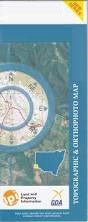
NSW 7237
Mount Arrowsmith
Digital Products: You will receive an email shortly after checkout containing links to download your products.
If you do not receive this email within 30min, please check your Junk / SPAM email folder, prior to contacting us.
Description
This Topographic Map is produced by the New South Wales Government.
This map is supplied in digital in PDF format, which means it can be printed at home or sent to a professional printer for a 100% scale reproduction.
At this scale, 1cm on this map represents 1km on the ground. A standard map (which is square) covers an area of approximately 54km by 54km, with a contour interval of 20m. This map contains natural and constructed features including road and rail infrastructure, vegetation, hydrography, contours, localities and some administrative boundaries.
South Mount Browne Boullia Mount Arrowsmith Pincally Dalmuir Pimpara Lake Arrowsmith Bald Hill Beef Wood Creek Box Hole Swamp Dead End Swamp Gravel Creek Gum Creek Lake Wallace Creek Max Tank Creek Mulcawee Creek Mulga Creek Pinpira Lake Puppy Dog Hill Sandy Creek Tabita Creek Tarita Creek Tarlta Creek Three Mile Swamp Tobacco Bush Creek Yarramurtie Creek Bullea Lake Burr Creek Yarramurtie Dam Arnheim Bullia Coopayandra Marracoota Pingbilly Wydjah Yarramurtie Gununah Wydjah Well Wydgah Well Evelyn Creek Fincally Boxhole Pimpara