
NSW 7230
Bunnerungee
Digital Products: You will receive an email shortly after checkout containing links to download your products.
If you do not receive this email within 30min, please check your Junk / SPAM email folder, prior to contacting us.
Description
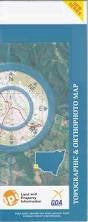
This Topographic Map is produced by the New South Wales Government.
This map is supplied in digital in PDF format, which means it can be printed at home or sent to a professional printer for a 100% scale reproduction.
At this scale, 1cm on this map represents 1km on the ground. A standard map (which is square) covers an area of approximately 54km by 54km, with a contour interval of 20m. This map contains natural and constructed features including road and rail infrastructure, vegetation, hydrography, contours, localities and some administrative boundaries.
Milkengay Nindethana Bunnerungee Coleraine Toora Quambi Warrigal Watara Bulpunga Lamplough Wilton Dunvegan Glen-Esk Sturts Billabong Allanvale Orchard Bend Bellevue Tara Downs Milpara Avoca Tapio Tooperoopna Warrananga Andruco Lagoon Anderson Waterhole Cudmore Lake Milkengay Milkengay Lake Neilpo Palineua Road Hill Sandy Gate Well Stud Bend Tinghi Creek Toora Lake Boolonkeena Dinwoodie Fitzroy Foster Franklin Lindsay Stephen Waltragile Wilpatera Bingoo Bunneringee Lissan Moorpa Tugima Marcoonia Pernolingay Anabranch Anabranch South Johnsons Tank Dead Horse Tank Balpunga Bellvue Aveca Wilpatara Walpatera