
NSW 7131
Scotia
Digital Products: You will receive an email shortly after checkout containing links to download your products.
If you do not receive this email within 30min, please check your Junk / SPAM email folder, prior to contacting us.
Description
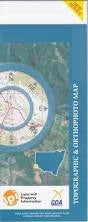
This Topographic Map is produced by the New South Wales Government.
This map is supplied in digital in PDF format, which means it can be printed at home or sent to a professional printer for a 100% scale reproduction.
At this scale, 1cm on this map represents 1km on the ground. A standard map (which is square) covers an area of approximately 54km by 54km, with a contour interval of 20m. This map contains natural and constructed features including road and rail infrastructure, vegetation, hydrography, contours, localities and some administrative boundaries.
Loch Lilly Ennisvale Nanya Tarrara Belvedere Tarawi Gypsum Flats Kopi Plain Mount Massidon Old Man Plain Waterholes Danggali Salt Lake Amoskeag South Grose Phillip Popica Winnebaga Woolcunda Yarllalla Yarllalla South Young Badham Boree Popica South Tarawi Nature Reserve Michael Gavin Park Scotia Bowerman Cummings Tarana Woolcunda Tank Canegrass Bore Amoskeag Tank