
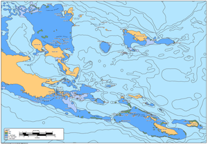
Regional Chart of SE PNG
This chart shows the SE of Papua New Guinea, with Island chains and individual island names placed, along with major population centres.
There is very little mapping for PNG, and our client was keen to have a big, but simple map on the wall to better understand their region.
We worked with the client to determine the whether it was best to use local or anglicized names.
This was printed and laminated for use as a wall map.
