
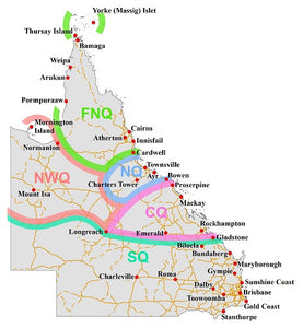
Queensland Regions
This was an interesting little map to put together.
While the base layers are fairly stock standard (State boundary, Roads, Localities), the drawing on the dividing arcs presented a unique challenge.
These lines are "general" and geospatial systems rely on precise points (vertices)... so we had to apply some filters and a smoothing algorithm to make the boundary lines less precise and more flowly.
