
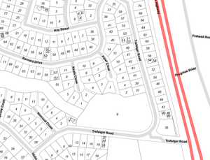
Numbered Properties in Mount Sheridan
Here is an extract of us combining several disparate datasets to achieve something recognisable to the average person.
Most people understand addresses as Number X, ABC St; however councils use lot numbers and various other systems - which means that to draw the image you see requires a lot of background work marry up the "common" street address, with the actual shape of the property.
To add to the confusion, some properties span multiple lots, some lots contains multiple dwellings (ie: 5A, 5B).
The simple addition of the street numbers turns this map from polygons next to roads, to a map with real application.
