
Emergency Management Maps
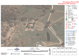
For this project we were asked to develop a series of A2 sized "Emergency Plan" maps for a Rural Fire Brigade in NSW for issuing to all the home owners in their region.
Each map contained a different satellite image at the centre; focusing on the major asset requiring protection.
The home owners would mark up the map (using the legend on the right), which would then give the RFB a set of "plans" for each house, including important information like were dangerous goods were stored; what sort of water supply was available.
The work was funded by sponsorship from the NRMA.
